[]
Your ongoing selection
Asset(s) Assets
Your quote 0

Your selection

Clear selection
Item added to cart
View cart and checkout
{"event":"pageview","page_type1":"undetected","page_type2":"_assets_search_override","language":"en","user_logged":"false","user_type":"ecommerce","nl_subscriber":"false"}
{"event":"ecommerce_event","event_name":"view_item","event_category":"browse_catalog","ecommerce":{"items":[{"item_id":"EPL6869200","item_category":"illustration","item_category2":"out_of_copyright","item_category3":"standard","item_category5":"not_balown","item_list_name":"search_results","item_name":"flat_earth_magazine","item_variant":"undefined"},{"item_id":"EPL6869208","item_category":"illustration","item_category2":"out_of_copyright","item_category3":"standard","item_category5":"not_balown","item_list_name":"search_results","item_name":"flat_earth_theory_the_earth_as_a_single_flat_plane","item_variant":"undefined"},{"item_id":"EPL7052636","item_category":"illustration","item_category2":"out_of_copyright","item_category3":"standard","item_category5":"not_balown","item_list_name":"search_results","item_name":"flat_earth_theory_the_earth_as_a_single_flat_plane","item_variant":"undefined"},{"item_id":"UIG601597","item_category2":"no_copyright","item_category3":"standard","item_category5":"not_balown","item_list_name":"search_results","item_name":"world_in_geographic_projection_true_colour_satellite_image","item_variant":"undefined"},{"item_id":"UIG1578440","item_category":"illustration","item_category2":"out_of_copyright","item_category3":"standard","item_category5":"not_balown","item_list_name":"search_results","item_name":"sketch_of_africa_from_fra_mauro_s_great_map_of_the_world_1457","item_variant":"undefined"},{"item_id":"EPL6939074","item_category":"illustration","item_category2":"out_of_copyright","item_category3":"standard","item_category5":"not_balown","item_list_name":"search_results","item_name":"flat_earth_puzzle","item_variant":"undefined"},{"item_id":"UIG1578399","item_category":"illustration","item_category2":"out_of_copyright","item_category3":"standard","item_category5":"not_balown","item_list_name":"search_results","item_name":"the_pillars_of_hercules_as_shown_in_the_anglo_saxon_map_of_the_world_tenth_century","item_variant":"undefined"},{"item_id":"UIG3740697","item_category2":"out_of_copyright","item_category3":"standard","item_category5":"not_balown","item_list_name":"search_results","item_name":"thales_of_miletus_concept_of_a_flat_earth","item_variant":"undefined"},{"item_id":"UIG1578407","item_category":"illustration","item_category2":"out_of_copyright","item_category3":"standard","item_category5":"not_balown","item_list_name":"search_results","item_name":"a_portion_of_an_old_roman_map_of_the_world_showing_the_roads_through_the_empire_rivers_mountains_and","item_variant":"undefined"},{"item_id":"UIG1578436","item_category":"illustration","item_category2":"out_of_copyright","item_category3":"standard","item_category5":"not_balown","item_list_name":"search_results","item_name":"the_anglo_saxon_map_of_the_world","item_variant":"undefined"},{"item_id":"UIG1578401","item_category":"illustration","item_category2":"out_of_copyright","item_category3":"standard","item_category5":"not_balown","item_list_name":"search_results","item_name":"jerusalem_the_centre_of_the_world","item_variant":"undefined"},{"item_id":"UIG1578438","item_category":"illustration","item_category2":"out_of_copyright","item_category3":"standard","item_category5":"not_balown","item_list_name":"search_results","item_name":"the_voyage_to_cape_blanco_from_cape_bojador","item_variant":"undefined"},{"item_id":"UIG1578439","item_category":"illustration","item_category2":"out_of_copyright","item_category3":"standard","item_category5":"not_balown","item_list_name":"search_results","item_name":"a_portion_of_africa_from_fra_mauro_s_map","item_variant":"undefined"},{"item_id":"UIG1578437","item_category":"illustration","item_category2":"out_of_copyright","item_category3":"standard","item_category5":"not_balown","item_list_name":"search_results","item_name":"africa_from_ceuta_to_madeira_the_canaries_and_cape_bojador","item_variant":"undefined"},{"item_id":"UIG1578416","item_category":"illustration","item_category2":"out_of_copyright","item_category3":"standard","item_category5":"not_balown","item_list_name":"search_results","item_name":"the_mountain_of_cosmas_causing_night_and_day_and_the_seasons","item_variant":"undefined"},{"item_id":"UIG1578398","item_category":"illustration","item_category2":"out_of_copyright","item_category3":"standard","item_category5":"not_balown","item_list_name":"search_results","item_name":"the_pillars_of_hercules_as_shown_in_a_mediaeval_map","item_variant":"undefined"},{"item_id":"UIG1578415","item_category":"illustration","item_category2":"out_of_copyright","item_category3":"standard","item_category5":"not_balown","item_list_name":"search_results","item_name":"the_world_map_of_cosmas","item_variant":"undefined"},{"item_id":"EPL6773612","item_category":"illustration","item_category2":"out_of_copyright","item_category3":"standard","item_category5":"not_balown","item_list_name":"search_results","item_name":"depiction_of_a_flat_planet_earth","item_variant":"undefined"},{"item_id":"UIG1578403","item_category":"illustration","item_category2":"out_of_copyright","item_category3":"standard","item_category5":"not_balown","item_list_name":"search_results","item_name":"the_coast_of_africa_after_ptolemy_mercator_s_edition","item_variant":"undefined"},{"item_id":"UIG1578431","item_category":"illustration","item_category2":"out_of_copyright","item_category3":"standard","item_category5":"not_balown","item_list_name":"search_results","item_name":"the_hereford_mappa_mundi_1280","item_variant":"undefined"},{"item_id":"UIG1578433","item_category":"illustration","item_category2":"out_of_copyright","item_category3":"standard","item_category5":"not_balown","item_list_name":"search_results","item_name":"a_t_map_13th_century","item_variant":"undefined"},{"item_id":"UIG601598","item_category2":"no_copyright","item_category3":"standard","item_category5":"not_balown","item_list_name":"search_results","item_name":"world_with_arctic_ice_pack_in_geographic_projection_true_colour_satellite_image","item_variant":"undefined"},{"item_id":"UIG1578434","item_category":"illustration","item_category2":"out_of_copyright","item_category3":"standard","item_category5":"not_balown","item_list_name":"search_results","item_name":"a_t_map_tenth_century","item_variant":"undefined"},{"item_id":"UIG601599","item_category2":"no_copyright","item_category3":"standard","item_category5":"not_balown","item_list_name":"search_results","item_name":"world_at_night_satellite_image","item_variant":"undefined"},{"item_id":"UIG1578435","item_category":"illustration","item_category2":"out_of_copyright","item_category3":"standard","item_category5":"not_balown","item_list_name":"search_results","item_name":"a_king_holding_the_world_from_a_12th_century_manuscript","item_variant":"undefined"},{"item_id":"UIG1578432","item_category":"illustration","item_category2":"out_of_copyright","item_category3":"standard","item_category5":"not_balown","item_list_name":"search_results","item_name":"the_hereford_mappa_mundi_of_1280","item_variant":"undefined"},{"item_id":"UIG1578393","item_category":"illustration","item_category2":"out_of_copyright","item_category3":"standard","item_category5":"not_balown","item_list_name":"search_results","item_name":"the_garden_of_eden_with_its_four_rivers","item_variant":"undefined"},{"item_id":"LLM3655141","item_category":"illustration","item_category2":"out_of_copyright","item_category3":"standard","item_category4":"english_school_19th_century","item_category5":"not_balown","item_list_name":"search_results","item_name":"evidence_of_the_spherical_form_of_the_earth_engraving","item_variant":"undefined"},{"item_id":"XLF3792567","item_category2":"out_of_copyright","item_category3":"standard","item_category5":"balown","item_list_name":"search_results","item_name":"the_earth_as_a_disc_floating_on_the_water_from_astronomy_for_all_1911_print","item_variant":"undefined"},{"item_id":"XOS3086646","item_category":"illustration","item_category2":"out_of_copyright","item_category3":"standard","item_category4":"korean_school_18th_century","item_category5":"balown","item_list_name":"search_results","item_name":"chonhado_world_map","item_variant":"undefined"},{"item_id":"LLM3642518","item_category":"illustration","item_category2":"out_of_copyright","item_category3":"standard","item_category4":"english_school_20th_century","item_category5":"not_balown","item_list_name":"search_results","item_name":"why_is_a_flat_map_inaccurate_litho","item_variant":"undefined"},{"item_id":"UIG542200","item_category2":"out_of_copyright","item_category3":"standard","item_category5":"not_balown","item_list_name":"search_results","item_name":"reconstruction_of_medieval_conception_of_the_universe_showing_a_flat_earth_surrounded_by_the_crystal","item_variant":"undefined"},{"item_id":"UIG528842","item_category":"photo","item_category2":"no_copyright","item_category3":"standard","item_category5":"not_balown","item_list_name":"search_results","item_name":"world_flat_projection_map_from_composite_of_satellite_images_credit_nasa_science_earth_geology_ocean","item_variant":"undefined"},{"item_id":"UIG531055","item_category2":"out_of_copyright","item_category3":"standard","item_category4":"unknown_artist_16th_century","item_category5":"not_balown","item_list_name":"search_results","item_name":"archimedes_standing_on_earth_from_archimedes_tetragonismus_1503_print","item_variant":"undefined"},{"item_id":"UIG1578430","item_category":"illustration","item_category2":"out_of_copyright","item_category3":"standard","item_category5":"not_balown","item_list_name":"search_results","item_name":"the_torino_map_of_the_world","item_variant":"undefined"},{"item_id":"UIG538845","item_category2":"out_of_copyright","item_category3":"standard","item_category5":"not_balown","item_list_name":"search_results","item_name":"god_creating_eve_from_adam_s_rib_bible_genesis_illustrates_thales_concept_of_flat_earth_floating_on_","item_variant":"undefined"},{"item_id":"UIG534526","item_category2":"out_of_copyright","item_category3":"standard","item_category5":"not_balown","item_list_name":"search_results","item_name":"anglo_saxon_map_of_900s_showing_a_flat_earth_and_the_ocean_that_was_thought_to_surround_it_british_m","item_variant":"undefined"},{"item_id":"LLM3626109","item_category":"illustration","item_category2":"out_of_copyright","item_category3":"standard","item_category4":"english_school_19th_century","item_category5":"not_balown","item_list_name":"search_results","item_name":"the_english_labourer_engraving","item_variant":"undefined"},{"item_id":"NWI4901273","item_category":"illustration","item_category2":"out_of_copyright","item_category3":"standard","item_category5":"not_balown","item_list_name":"search_results","item_name":"world_map_of_a_flat_earth_printed_by_beatus_rhenanus_bild_aus_rheinau_early_1500_s","item_variant":"undefined"},{"item_id":"UIG1578405","item_category":"illustration","item_category2":"out_of_copyright","item_category3":"standard","item_category5":"not_balown","item_list_name":"search_results","item_name":"alexandria_in_pizzigani_s_map","item_variant":"undefined"},{"item_id":"NWI4846095","item_category":"illustration","item_category2":"out_of_copyright","item_category3":"standard","item_category5":"not_balown","item_list_name":"search_results","item_name":"world_map_of_claude_ptolemee_claudius_ptolemaeus_90_168_illustrating_the_flat_earth_colourful_engrav","item_variant":"undefined"},{"item_id":"PIX4614822","item_category":"photo","item_category2":"no_copyright","item_category3":"standard","item_category4":"miller_ron_b_1947","item_category5":"not_balown","item_list_name":"search_results","item_name":"moon_formation_of_the_seas_ancient_moon_formation_of_the_mare_for_millions_of_years_lava_flows_cover","item_variant":"undefined"},{"item_id":"UIG1578406","item_category":"illustration","item_category2":"out_of_copyright","item_category3":"standard","item_category5":"not_balown","item_list_name":"search_results","item_name":"north_britain_and_island_of_thule","item_variant":"undefined"},{"item_id":"NWI4848152","item_category":"illustration","item_category2":"out_of_copyright","item_category3":"standard","item_category5":"not_balown","item_list_name":"search_results","item_name":"world_map_depicting_the_flat_earth_by_greek_historian_herodote_484_or_482_425_bc_colourful_engraving","item_variant":"undefined"},{"item_id":"PIX4661623","item_category":"illustration","item_category2":"no_copyright","item_category3":"standard","item_category4":"walter_b_myers","item_category5":"not_balown","item_list_name":"search_results","item_name":"drepanaspis_drepanaspis_gemuendenensis_is_an_extirpated_species_of_jaw_free_fish_he_lived_in_the_inf","item_variant":"undefined"},{"item_id":"PIX4672818","item_category":"photo","item_category2":"no_copyright","item_category3":"standard","item_category5":"not_balown","item_list_name":"search_results","item_name":"sandy_cay_bahamas_seabed_currents_and_sandbanks_on_sandy_cay_and_long_island_bahamas_image_obtained_","item_variant":"undefined"},{"item_id":"PIX4661731","item_category":"illustration","item_category2":"no_copyright","item_category3":"standard","item_category4":"walter_b_myers","item_category5":"not_balown","item_list_name":"search_results","item_name":"doliosauriscus_doliosauriscus_was_a_fossil_carnivorous_reptile_of_the_order_of_therapsides_and_the_s","item_variant":"undefined"},{"item_id":"PIX4632589","item_category":"photo","item_category2":"no_copyright","item_category3":"standard","item_category5":"not_balown","item_list_name":"search_results","item_name":"earth_seen_at_night_2012_city_lights_2012_flat_map_earth_observed_at_night_by_satellite_composite_im","item_variant":"undefined"},{"item_id":"UIG3732380","item_category":"illustration","item_category2":"out_of_copyright","item_category3":"standard","item_category5":"not_balown","item_list_name":"search_results","item_name":"an_early_hindu_system_of_the_universe","item_variant":"undefined"},{"item_id":"PIX4630452","item_category":"photo","item_category2":"no_copyright","item_category3":"standard","item_category5":"not_balown","item_list_name":"search_results","item_name":"algerian_sahara_seen_by_satellite_algerian_sahara_seen_from_space_part_of_the_sahara_desert_in_south","item_variant":"undefined"},{"item_id":"PIX4675641","item_category":"photo","item_category2":"no_copyright","item_category3":"standard","item_category5":"not_balown","item_list_name":"search_results","item_name":"christchurch_and_the_peninsula_of_banks_new_zealand_from_space_christchurch_and_banks_peninsula_new_","item_variant":"undefined"},{"item_id":"PIX4658475","item_category":"photo","item_category2":"no_copyright","item_category3":"standard","item_category5":"not_balown","item_list_name":"search_results","item_name":"satellite_photo_of_the_rub_al_khali_desert_rub_al_khali_desert_seen_from_space_rub_al_khali_the_empt","item_variant":"undefined"},{"item_id":"PIX4661506","item_category":"photo","item_category2":"no_copyright","item_category3":"standard","item_category5":"not_balown","item_list_name":"search_results","item_name":"tibet_lhasa_satellite_view_lhasa_in_tibet_seen_from_space_the_capital_of_tibet_lhasa_seen_by_the_ter","item_variant":"undefined"},{"item_id":"PIX4630615","item_category":"photo","item_category2":"no_copyright","item_category3":"standard","item_category5":"not_balown","item_list_name":"search_results","item_name":"impact_crater_wolf_creek_australia_area_around_wolf_creek_impact_crater_australia_part_of_the_great_","item_variant":"undefined"},{"item_id":"LRI4648449","item_category":"illustration","item_category2":"out_of_copyright","item_category3":"standard","item_category4":"unknown_artist_15th_century","item_category5":"not_balown","item_list_name":"search_results","item_name":"world_map_of_claudius_ptolemaeus_claude_ptolemee_90_168_ap_jc_greek_astronomer_and_astrologer_repres","item_variant":"undefined"},{"item_id":"PIX4658462","item_category":"photo","item_category2":"no_copyright","item_category3":"standard","item_category5":"not_balown","item_list_name":"search_results","item_name":"satellite_photo_of_the_rub_al_khali_desert_rub_al_khali_desert_seen_from_space_rub_al_khali_the_empt","item_variant":"undefined"},{"item_id":"SZT3019634","item_category":"photo","item_category2":"no_copyright","item_category3":"standard","item_category5":"not_balown","item_list_name":"search_results","item_name":"christian_world_map_from_the_13th_century_b_w_photo","item_variant":"undefined"},{"item_id":"PIX4659777","item_category":"photo","item_category2":"no_copyright","item_category3":"standard","item_category5":"not_balown","item_list_name":"search_results","item_name":"bahrain_viewed_from_space_bahrain_and_parts_of_saudi_arabia_the_kingdom_of_bahrain_and_the_east_coas","item_variant":"undefined"},{"item_id":"ELS9200483","item_category":"illustration","item_category2":"out_of_copyright","item_category3":"standard","item_category4":"unknown_artist_15th_century","item_category5":"not_balown","item_list_name":"search_results","item_name":"full_page_god_creating_heaven_and_earth_coloured_pen_drawing","item_variant":"undefined"},{"item_id":"NWI4852574","item_category":"illustration","item_category2":"out_of_copyright","item_category3":"standard","item_category5":"not_balown","item_list_name":"search_results","item_name":"world_map_of_claudius_ptolemaeus_claude_ptolemee_90_168_ap_jc_greek_astronomer_and_astrologer_in_red","item_variant":"undefined"},{"item_id":"PIX4673091","item_category":"photo","item_category2":"no_copyright","item_category3":"standard","item_category4":"stephane_guisard","item_category5":"not_balown","item_list_name":"search_results","item_name":"tikal_the_pyramid_of_the_lost_world_and_the_constellation_orion_tikal_orion_constellation_above_mund","item_variant":"undefined"},{"item_id":"IWM3737655","item_category":"illustration","item_category2":"in_copyright","item_category3":"standard","item_category4":"freedman_barnett_1901_58","item_category5":"not_balown","item_list_name":"search_results","item_name":"aircraft_runway_in_course_of_construction_at_thelus_near_arras_may_1940_oil_on_canvas","item_variant":"undefined"},{"item_id":"PIX4673089","item_category":"photo","item_category2":"no_copyright","item_category3":"standard","item_category4":"stephane_guisard","item_category5":"not_balown","item_list_name":"search_results","item_name":"tikal_the_pyramid_of_the_lost_world_and_the_constellation_orion_tikal_orion_constellation_above_mund","item_variant":"undefined"},{"item_id":"UIG5311877","item_category":"illustration","item_category2":"out_of_copyright","item_category3":"standard","item_category5":"not_balown","item_list_name":"search_results","item_name":"an_early_depicting_of_the_hindu_system_of_the_universe","item_variant":"undefined"},{"item_id":"UIS5094225","item_category":"illustration","item_category2":"no_copyright","item_category3":"standard","item_category5":"not_balown","item_list_name":"search_results","item_name":"a_medieval_missionary_finds_the_point_where_sky_and_earth_touch_1888","item_variant":"undefined"},{"item_id":"PIX9022565","item_category":"photo","item_category2":"no_copyright","item_category3":"standard","item_category5":"not_balown","item_list_name":"search_results","item_name":"change_in_night_lights_between_2012_and_2023_photo","item_variant":"undefined"},{"item_id":"PIX12043391","item_category":"photo","item_category2":"no_copyright","item_category3":"standard","item_category5":"not_balown","item_list_name":"search_results","item_name":"earthset_viewed_from_the_orion_module_artemis_ii_earthset_artemis_ii_2026_photo","item_variant":"undefined"},{"item_id":"PIX12043388","item_category":"photo","item_category2":"no_copyright","item_category3":"standard","item_category5":"not_balown","item_list_name":"search_results","item_name":"earthset_viewed_from_the_orion_module_artemis_ii_earthset_artemis_ii_2026_photo","item_variant":"undefined"},{"item_id":"LIS372984","item_category":"illustration","item_category2":"in_copyright","item_category3":"standard","item_category4":"sheppard_raymond_1913_58","item_category5":"not_balown","item_list_name":"search_results","item_name":"ploughing_c_1940_w_c_on_paper","item_variant":"undefined"},{"item_id":"UIG1578424","item_category":"illustration","item_category2":"out_of_copyright","item_category3":"standard","item_category5":"not_balown","item_list_name":"search_results","item_name":"the_unrolling_of_the_clouds_the_world_as_known_at_the_end_of_the_13th_century_1754_illustration","item_variant":"undefined"},{"item_id":"PIX9022568","item_category":"photo","item_category2":"no_copyright","item_category3":"standard","item_category5":"not_balown","item_list_name":"search_results","item_name":"meteor_crater_arizona_usa_2024_photo","item_variant":"undefined"},{"item_id":"LSE4330239","item_category":"illustration","item_category2":"out_of_copyright","item_category3":"standard","item_category4":"french_school_19th_century","item_category5":"not_balown","item_list_name":"search_results","item_name":"a_jewish_orchestra_in_tlemcen_invariably_composed_of_5_instruments_the_rbab_mounts_on_2_strings_the_","item_variant":"undefined"},{"item_id":"EPL6930306","item_category":"photo","item_category2":"out_of_copyright","item_category3":"standard","item_category4":"downey_william_daniel_fl_1855_1940","item_category5":"not_balown","item_list_name":"search_results","item_name":"joseph_lyne_ignatius","item_variant":"undefined"},{"item_id":"PIX4613637","item_category":"photo","item_category2":"no_copyright","item_category3":"standard","item_category5":"not_balown","item_list_name":"search_results","item_name":"galaxy_eso_77_14_galaxy_eso_77_14_the_galaxy_eso_77_14_is_about_550_million_light_years_away_from_ea","item_variant":"undefined"},{"item_id":"PIX4636564","item_category":"photo","item_category2":"no_copyright","item_category3":"standard","item_category4":"stephane_guisard","item_category5":"not_balown","item_list_name":"search_results","item_name":"chimborazo_chimborazo_and_milky_way_the_lactee_road_over_the_chimborazo_volcano_6268_metres_in_ecuad","item_variant":"undefined"},{"item_id":"PIX4649416","item_category":"photo","item_category2":"no_copyright","item_category3":"standard","item_category5":"not_balown","item_list_name":"search_results","item_name":"decolishing_the_space_shuttle_atlantis_05_2010_space_shuttle_atlantis_lift_off_05_2010_decolving_the","item_variant":"undefined"},{"item_id":"PIX4649404","item_category":"photo","item_category2":"no_copyright","item_category3":"standard","item_category5":"not_balown","item_list_name":"search_results","item_name":"decolishing_the_space_shuttle_atlantis_05_2010_space_shuttle_atlantis_lift_off_05_2010_decolving_the","item_variant":"undefined"},{"item_id":"PIX4649419","item_category":"photo","item_category2":"no_copyright","item_category3":"standard","item_category5":"not_balown","item_list_name":"search_results","item_name":"decolishing_the_space_shuttle_atlantis_05_2010_space_shuttle_atlantis_lift_off_05_2010_decolving_the","item_variant":"undefined"},{"item_id":"PIX4637936","item_category":"photo","item_category2":"no_copyright","item_category3":"standard","item_category5":"not_balown","item_list_name":"search_results","item_name":"the_galactic_center_seen_by_spitzer_space_telescope_the_galactic_center_region_seen_by_spitzer_satel","item_variant":"undefined"},{"item_id":"UIG532257","item_category2":"no_copyright","item_category3":"standard","item_category5":"not_balown","item_list_name":"search_results","item_name":"cylindrical_projection_of_jupiter_s_surface","item_variant":"undefined"},{"item_id":"PIX4616602","item_category":"photo","item_category2":"no_copyright","item_category3":"standard","item_category5":"not_balown","item_list_name":"search_results","item_name":"sol_de_mars_seen_by_the_phoenix_probe_mars_phoenix_landing_site_image_obtained_by_the_phoenix_probe_","item_variant":"undefined"},{"item_id":"REU7653841","item_category":"photo","item_category2":"no_copyright","item_category3":"standard","item_category4":"mark_baker","item_category5":"not_balown","item_list_name":"search_results","item_name":"a_cook_islands_traditional_vaka_canoe_the_te_au_o_tonga_anchored_in_the_tahitian_capital_papeete_t_1","item_variant":"undefined"},{"item_id":"MNS1150085","item_category":"object","item_category2":"out_of_copyright","item_category3":"standard","item_category4":"japanese_school","item_category5":"not_balown","item_list_name":"search_results","item_name":"nyoirin_kannon_kamakura_period_bronze","item_variant":"undefined"},{"item_id":"BL3304020","item_category":"illustration","item_category2":"out_of_copyright","item_category3":"standard","item_category5":"not_balown","item_list_name":"search_results","item_name":"paper_globe_1780","item_variant":"undefined"},{"item_id":"UIS5071786","item_category":"photo","item_category2":"no_copyright","item_category3":"standard","item_category5":"not_balown","item_list_name":"search_results","item_name":"spacecraft_usa_viking_martian_landscape_seen_from_viking_1_1976","item_variant":"undefined"},{"item_id":"UIS5071800","item_category":"photo","item_category2":"no_copyright","item_category3":"standard","item_category5":"not_balown","item_list_name":"search_results","item_name":"manned_space_flight_usa_apollo_general_apollo_lunar_module_on_the_moon_1971_1972","item_variant":"undefined"},{"item_id":"NBY3673396","item_category":"illustration","item_category2":"out_of_copyright","item_category3":"standard","item_category4":"unknown_artist_19th_century","item_category5":"not_balown","item_list_name":"search_results","item_name":"goddess_teoyaomqui_and_porphyry_sacrificial_stone_c_1843_50_watercolour","item_variant":"undefined"},{"item_id":"PIX4610249","item_category":"photo","item_category2":"no_copyright","item_category3":"standard","item_category5":"not_balown","item_list_name":"search_results","item_name":"interacting_galaxies_ngc_2936_and_ngc_2937_interacting_galaxies_ngc_2936_and_ngc_2937_in_hydra_these","item_variant":"undefined"},{"item_id":"UIG5425955","item_category":"illustration","item_category2":"out_of_copyright","item_category3":"standard","item_category5":"not_balown","item_list_name":"search_results","item_name":"engraving_depicting_a_demonstration_of_how_the_flattening_of_the_earth_s_poles_is_due_to_centrifugal","item_variant":"undefined"},{"item_id":"PIX4658795","item_category":"photo","item_category2":"no_copyright","item_category3":"standard","item_category5":"not_balown","item_list_name":"search_results","item_name":"space_view_over_the_pyramid_of_giza_photo","item_variant":"undefined"}]}}
{"event":"custom_event","event_name":"view_search_result","event_category":"browse_catalog","keyword":"flat earth","search_type":"standard","search_bridgeman_artists":"false","search_mode":"automatic","search_zero_result":"false","search_results":90,"search_results_page_number":1}

'Flat Earth' images and/or videos results page 1 of 1

Main filters
Buy Print option
Royalty-Free Option
Ecommerce option
Reuters Results
Media Type
Orientation
Colour
Rights Type
Rights
More filters
Bridgeman Artists
Bridgeman Photographers
Century
Footage filters
Video Original Format
Video Resolution
Video Category
Filter group
Filter colors
Order By:
per page
Filter group
Rights Type
Media Type
No copyright
Filter colors

Display options

View
Image Size

Images of 'Flat Earth' found, 90

FLAT EARTH MAGAZINE
Permissions
  • Permission required for non-editorial use (inc book and magazine covers). Please contact us
Content Partner Restrictions
  • Only available to clients invoiced in France and North, Central and South America
Flat Earth Theory - the Earth as a single flat plane
Permissions
  • Permission required for non-editorial use (inc book and magazine covers). Please contact us
Content Partner Restrictions
  • Only available to clients invoiced in France and North, Central and South America
Flat Earth Theory - the Earth as a single flat plane
Permissions
  • Permission required for non-editorial use (inc book and magazine covers). Please contact us
Content Partner Restrictions
  • Only available to clients invoiced in France and North, Central and South America
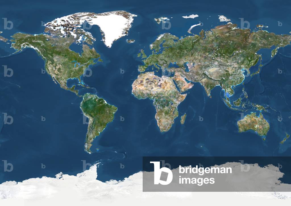
World In Geographic Projection, True Colour Satellite Image
Sketch of Africa from Fra Mauro's Great Map of the World, 1457
Flat Earth Puzzle
Permissions
  • Permission required for non-editorial use (inc book and magazine covers). Please contact us
Content Partner Restrictions
  • Only available to clients invoiced in France and North, Central and South America
The Pillars of Hercules, as shown in the Anglo-Saxon map of the world, tenth century
Thales of Miletus' concept of a flat earth
The "Anglo-Saxon" map of the World
Jerusalem, the centre of the world
The voyage to Cape Blanco from Cape Bojador
A portion of Africa from Fra Mauro's map
Africa - from Ceuta to Madeira, the canaries and Cape Bojador
The mountain of Cosmas, causing night and day and the seasons
The Pillars of Hercules, as shown in a mediaeval map
The world map of Cosmas
Depiction of a flat planet Earth
Permissions
  • Permission required for non-editorial use (inc book and magazine covers). Please contact us
Content Partner Restrictions
  • Only available to clients invoiced in France and North, Central and South America
The coast of Africa, after Ptolemy (Mercator's edition)
The Hereford Mappa Mundi, 1280
A T-map, 13th century
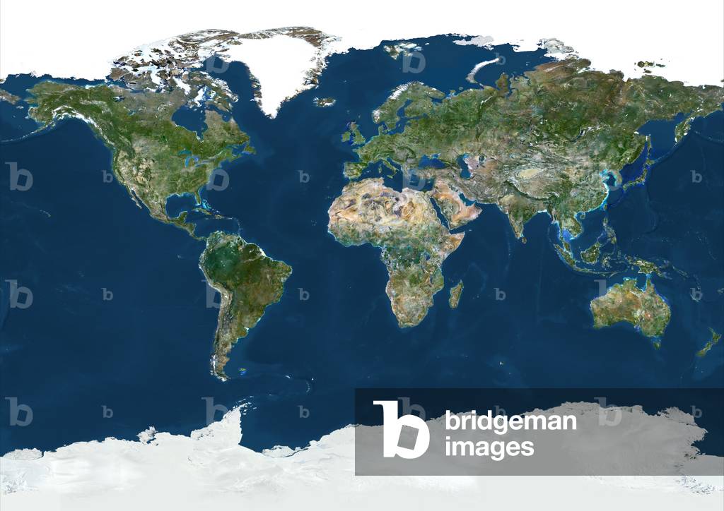
World With Arctic Ice Pack In Geographic Projection, True Colour Satellite Image
A T-map, tenth century
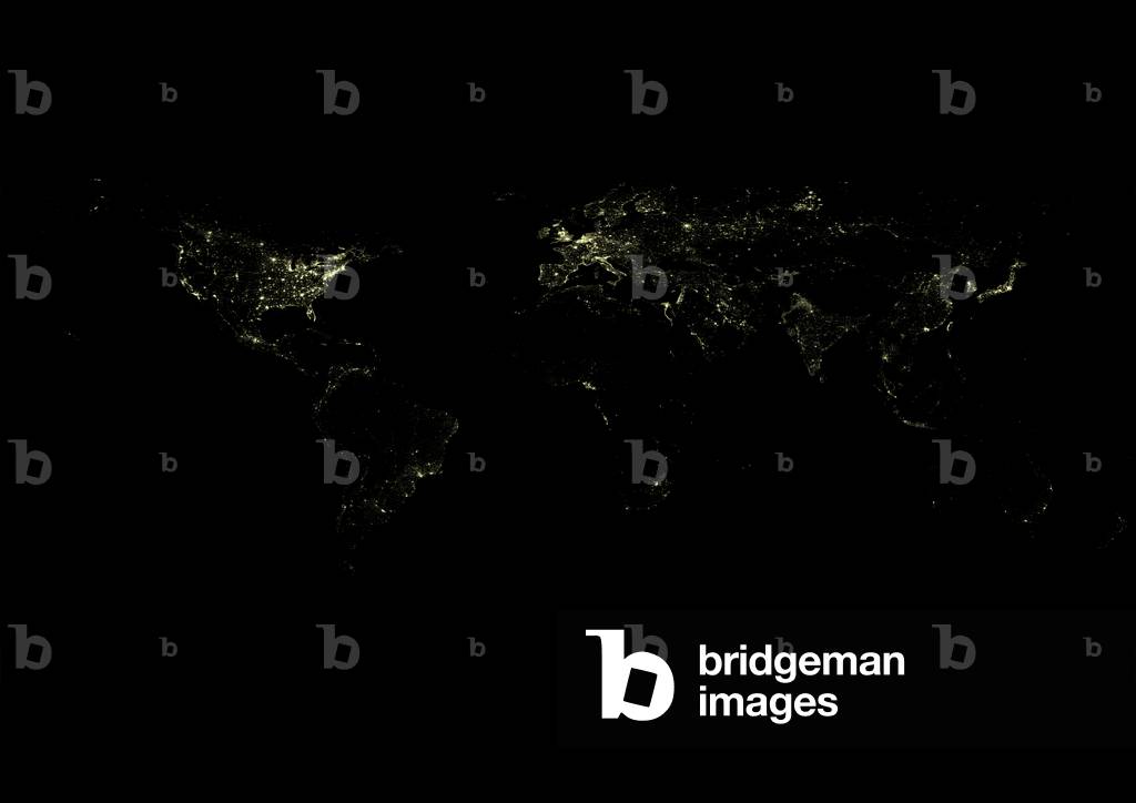
World At Night, Satellite Image
A king holding the world. From a 12th century manuscript
The Hereford Mappa Mundi of 1280
The Garden of Eden with its four rivers
The earth as a disc floating on the water, from ‘Astronomy for All’, 1911 (print)
The Torino map of the World
World map of a flat earth, printed by Beatus Rhenanus (Bild aus Rheinau), early 1500 s.
Alexandria in Pizzigani's Map
North Britain and Island of Thule
Drepanaspis - Drepanaspis gemuendenensis is an extirpated species of jaw-free fish. He lived in the inferior Devonian. An 8-inch-long primitive jawless fish of the species Drepanaspis gemuendenensis settles on the bottom of a shallow Devonian sea 380 million years ago. With a flat, paddle-shaped head and upwards-facing jawless mouth, Drepanaspis was one of the more unique sea creatures of its time. Based upon its overall shape it is believed to have been a bottom feeder, though it's not known what it would have eaten
Sandy Cay - Bahamas - Seabed currents and sandbanks on Sandy Cay and Long Island, Bahamas. Image obtained on 27 November 2010 from the International Space Station (ISS). This astronaut photograph, taken from the International space station on November 27, 2010, provides a view of tidal flats and channels near Sandy Cay, on the western side of Long Island and along the eastern margin of the Great Bahama Bank (North is top). The continuously exposed parts of the island are brown, a result of soil formation and vegetation growth. To the north of Sandy Cay, an off - white tidal flat composed of carbonate sediments is visible; light blue - green regions indicate shallow water on the tidal flat. The tidal flow of seawater is concentrated through gaps in the land surface, leading to the formation of relatively deep channels that cut into the sediments. The channels and areas to the south of the island have a vivid blue color that indicates deeper water
Doliosauriscus - Doliosauriscus was a fossil carnivorous reptile of the order of Therapsides and the suborder of Dinocephales. He lived in the middle of Permian about 265 million years ago. In the picture, in the background, a dimetrodon. 12-foot-long dinocephalian therapsids of the genus Doliosauriscus face off in a dry mid-permian landscape 265 million years ago in what is today Russia. On the horizon is a synapsid of the genus Dimetrodon. Vegetation includes various ferns and cycads. Similar to its better-known relative Titanophoneus, Doliosauriscus was a carnivore, one of the largest predators of its time with large dagger-like canines in front and sharp incisors and flat molars in back for grinding up flesh
Earth seen at night - 2012 - City Lights 2012 - Flat map - Earth observed at night by satellite. Composite image obtained by the Suomi NPP satellite in April and October 2012. NASA image acquired April 18 - October 23, 2012 This image of the Earth at night is a composite assembled from data acquired by the Suomi National Polar - orbiting Partnership (Suomi NPP) satellite over nine days in April 2012 and thirteen days in October 2012. It took 312 orbits and 2.5 terabytes of data to get a clear shot of every parcel of Earth's land surface and islands
An early Hindu system of the universe
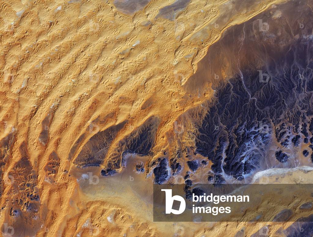
Algerian Sahara seen by satellite - Algerian Sahara seen from space: Part of the Sahara desert, in southeast Algeria. The Japanese satellite ALOS (Advanced Land Observation Satellite) took this image on 28 January 2011. This satellite image was captured over southeastern Algeria in the heart of the Sahara desert. In this image, a large area of rock appearing purple stretches across the right side of the image, with fluvial erosion patterns testament to an earlier time when the area received more rainfall. Today, this area sees an average of about 10 mm of rainfall per year. Windshaped sand dunes are visible on the left. The area at the bottom appears to be flat, with tiny specks of vegetation. Just south of this image lies the Tassili n 'Ajjer National Park and UNESCO World Heritage Site, renowned for its 10 000 year-old cave art. The drawings and engravings depict culture and the environment from a time when climatic conditions were more favourable to human occupation. Japan's ALOS satellite recorded this image on 28 January 2011
Christchurch and the Peninsula of Banks (New Zealand) from space - Christchurch and Banks Peninsula, New Zealand - The Peninsula of Banks and the City of Christchurch seen from the International Space Station (ISS) on August 15, 2006. The Banks Peninsula is an ancient erode volcano forming a peninsula on the east coast of the South Island. Oblique view (the photograph was taken from a side angle) of the city of Christchurch, New Zealand. Snow highlights the peaks of the Banks Peninsula to the southeast of the city. The peninsula has a radically different landscape compared to the adjoining, flat Canterbury Plains, where Christchurch (gray patch to the north) is located. The Banks Peninsula is formed from the overlapping cones of the extinct Lyttelton and Akaroa volcanoes. Subsequent erosion of the cones formed the heavily dissected terrain visible in the image, and sea level rise led to the creation of several harbors around the Peninsula. Erosion continues unabated today, as evidenced by the apron of greenish blue, sediment - laden waters surrounding the Banks Peninsula. Other interesting features in the image include the braided Waimakariri River to the north - northwest of the city, and the greenish brown waters of Lake Ellesmere at image left. The coloration of the water is due both to its shallow depth (1.4 meters on average) and its high concentrations of nitrogen and phosphorus, which fertilizes the growth of large amounts of green algae
Satellite photo of the Rub al Khali desert - Rub 'al Khali desert seen from space - Rub al-Khali (the Empty Quarter), is one of the largest deserts and the largest uninterrupted expanse of sand in the world. It covers nearly 600,000 square kilometres in the Arabian Peninsula, located mostly in Saudi Arabia and in the territories of Yemen, Oman and the United Arab Emirates. The image obtained by the Terra satellite on 2 December 2005 covers an area of 54.8 km by 61.9 km and shows the fields of sand dunes separated by flat and saline stretches, sebkha (or sabkha). The Arabian Peninsula's Empty Quarter, known as Rub 'al Khali, is the world's largest sand sea, holding about half as much sand as the Sahara Desert. The Empty Quarter covers 583,000 square kilometers (225,000 square miles), and stretches over parts of Saudi Arabia, Yemen, Oman, and the United Arab Emirates. The ASTER instrument on Nasa's Terra satellite captured this image of the Empty Quarter on December 2, 2005, covering an area of 54.8 x 61.9 km, located near 20.7 degrees north latitude, 53.6 degrees east. Grey White salt flats, known as sebkhas or sabkhas, separate the dunes
Tibet: Lhasa satellite view - Lhasa in Tibet seen from space - The capital of Tibet, Lhasa seen by the Terra satellite on November 24, 2005. Located at 3650 meters above sea level on the Tibet plateau, Lhasa is one of the highest cities in the world. On this image in perspective, seen in false colours, vegetation appears in red, mountains in brown, dwellings and infrastructure in grey. With an elevation of 3,650 meters (11,975 feet), Lhasa, the administrative capital of the Tibet Autonomous Region in China, is one of the highest elevation cities in the world. The city fills a flat river valley nestled in the ranges of the Himalaya Mountains in southern China. This image taken on November 24, 2005 from the Advanced Spaceborne Thermal Emission and Reflection Radiometer (ASTER) on Nasa's Terra satellite, provides a three - dimensional view of the landscape created from the instrument's stereo sensors. False color image in which plant - covered land is red, man - made surfaces tend to be silver or white, the high mountains are brown
Impact Crater Wolf Creek, Australia - Area around Wolf Creek impact crater, Australia - Part of the Great Sable Desert with Wolf Creek impact crater (or Wolfe Creek, top left) in Australia, seen by Terra satellite on September 22, 2006. It would have been formed about 300,000 years ago and its diameter is 880 metres. Wolfe Creek Crater lies on the edge of the Great Sandy Desert approximately 90 km south of Halls Creek in Western Australia. Almost circular, Wolfe Creek Crater (also known as Wolf Creek Crater, top middle left) is considered the second largest crater in the world from which meteorite fragments have been collected. Because of its excellent preservation, the crater clearly shows the classic features that result from a large meteorite striking the Earth. The Advanced Spaceborne Thermal Emission and Reflection Radiometer (ASTER) on Nasa's Terra satellite captured this image of Wolfe Creek Crater on September 22, 2006. The Australian Outback appears mostly in varying earth tones in this simulated - true - color image. Deep green indicates vegetation lining the winding stream west of the crater. A road leads to the crater's rim, approaching from the south, then turning east. The crater itself appears fairly dark brown, but a bright white splotch occupies the crater's center. Wolfe Creek Crater measures roughly 880 meters (2,890 feet) in diameter, and the mostly flat crater floor sits some 55 meters (180 feet) below the crater rim and some 25 meters (82 feet) below the sand plain outside of the crater. At the crater's center, the ground rises slightly, and includes gypsum - - probably responsible for the bright white spot in this image - - and some surprisingly large trees. Geologists studying the crater have estimated that it formed some 300,000 years ago when a meteorite weighing more than 50,000 metric tons struck the Earth at an estimated 15 kilometers (9.3 miles) per second
Satellite photo of the Rub al Khali desert - Rub 'al Khali desert seen from space - Rub al-Khali (the Empty Quarter), is one of the largest deserts and the largest uninterrupted expanse of sand in the world. It covers nearly 600,000 square kilometres in the Arabian Peninsula, located mostly in Saudi Arabia and in the territories of Yemen, Oman and the United Arab Emirates. The image obtained by the Landsat-7 satellite on 26 August 2001 shows the sand dune fields separated by flat and saline stretches, sebkha (or sabkha). The Arabian Peninsula's Empty Quarter, known as Rub 'al Khali, is the world's largest sand sea, holding about half as much sand as the Sahara Desert. The Empty Quarter covers 583,000 square kilometers (225,000 square miles), and stretches over parts of Saudi Arabia, Yemen, Oman, and the United Arab Emirates. The Enhanced Thematic Mapper on Nasa's Landsat 7 satellite captured this image of the Empty Quarter on August 26, 2001. The area shown resides in southeastern Saudi Arabia, midway between the United Arab Emirates to the north and Oman in the south. Parallel rows of salmon - pink and white alternate to create a rippling pattern. White salt flats, known as sebkhas or sabkhas, separate the dunes. These salt - encrusted plains vary in hardness, in some places creating a surface strong enough to drive a vehicle over, in other places disappearing into sand. The sand dunes soar above the salt plains between them
Christian world map from the 13th century (b/w photo)
Image Restrictions
  • Content within this photograph may require additional clearances (eg: trademark and personality rights) depending on Licensee's specific use of material, which may include book and magazine cover use.
Bahrain viewed from space - Bahrain and parts of Saudi Arabia: The Kingdom of Bahrain and the East Coast of Saudi Arabia seen by Sentinel-2A satellite on 18 September 2015 - This beautiful, natural-colour image from Sentinel-2A on 18 September 2015 features the small nation of Bahrain and parts of eastern Saudi Arabia - Located on the southwestern coast of the Persian Gulf, Bahrain is a small Arab state, made up of an archipelago consisting of Bahrain Island and some 30 smaller islands - In the middle of the image, on the Persian Gulf, the King Fahd Causeway is clearly visible. Built between 1981 and 1986, it consists of a series of bridges and stretches of road connecting Saudi Arabia and Bahrain. The Saudi and Bahraini passport control centres are also noticeable in the middle of the Causeway - On the right of the image is the island of Bahrain, home to some 1.5 million people, with its modern capital Manama featured at the top. The greys represent the densely built city centre and surrounding towns - On the top right part of the island, on a smaller island about 7 km northeast of the capital, Bahrain International Airport is visible - Most of Bahrain is a flat and arid desert plain, with recurrent droughts and dust storms the main natural dangers for its inhabitants. Famous for its pearl fisheries for centuries, today it is also known for its financial, commercial and communications sectors - Towards the central left part of the island, Bahrain University is observable. Also visible, the Al Areen Wildlife Reservation, both a nature reserve and zoo, one of the five protected areas of the country, and the only protected area on land - On the bottom-right tip of the island a series of horseshoe-shaped artificial atolls are clearly visible. Durrat Al Bahrain, one of the largest artificial islands in Bahrain, comprises six atolls and five fish-shaped islands - On the left side of the image, in Saudi Arabia, part of the Rub 'al-Khali, the world's largest sand desert,
Tikal - The Pyramid of the Lost World and the constellation Orion - Tikal - Orion constellation above Mundo Perdido Temple - 30 m tall, the Pyramid of the Lost World (Structure 5C - 54) constituted the largest edifice of Tikal until the seventh century. It is located in the south-west part of the central core of Tikal, south of Temple III and west of Temple V. The pyramid forms, with three small buildings located to the east, an Ensemble E which would have had astronomical significance. Tikal (or Tik'al according to modern Mayan spelling) is one of the largest archaeological sites and urban centers of the Mayan precolombian civilization. Located in what is now northern Guatemala, it was declared a UNESCO World Heritage Site in 1979. The Lost World Pyramid (Structure 5C - 54) lies in the southwest portion of Tikal's central core, south of Temple III and west of Temple V. It was decorated with stucco masks of the sun god and dates to the Late Preclassic; this pyramid is part of an enclosed complex of structures that remained intact and un - impacted by later building activity at Tikal. By the end of the Late Preclassic this pyramid was one of the largest structures in the Maya region. It attained its final form during the reign of Chak Tok Ich'aak in the 4th century AD, in the Early Classic, standing more than 30 metres (98 ft) high with stairways on all four sides and a flat top that possibly supported a superstructure built from perishable materials.Although the plaza later suffered significant alteration, the organization of a group of temples on the east side of this complex adheres to the layout that defines the so - called E - Groups, identified as solar observatories. Tikal (or Tik'al according to the modern Mayan orthography) is one of the largest archaeological sites and urban centres of the pre-Columbian Maya civilization. It is located in the archaeological region of the Peten Basin in what is now northern Guatemala. In 1979 it was dec
Aircraft Runway in course of Construction at Thélus: near Arras, May 1940 (oil on canvas)
Permissions
  • Permission required for non-editorial use (inc book and magazine covers). Please contact us
Copyright
  • Copyright Applies
Tikal - The Pyramid of the Lost World and the constellation Orion - Tikal - Orion constellation above Mundo Perdido Temple - 30 m tall, the Pyramid of the Lost World (Structure 5C - 54) constituted the largest edifice of Tikal until the seventh century. It is located in the south-west part of the central core of Tikal, south of Temple III and west of Temple V. The pyramid forms, with three small buildings located to the east, an Ensemble E which would have had astronomical significance. Tikal (or Tik'al according to modern Mayan spelling) is one of the largest archaeological sites and urban centers of the Mayan precolombian civilization. Located in what is now northern Guatemala, it was declared a UNESCO World Heritage Site in 1979. The Lost World Pyramid (Structure 5C - 54) lies in the southwest portion of Tikal's central core, south of Temple III and west of Temple V. It was decorated with stucco masks of the sun god and dates to the Late Preclassic; this pyramid is part of an enclosed complex of structures that remained intact and un - impacted by later building activity at Tikal. By the end of the Late Preclassic this pyramid was one of the largest structures in the Maya region. It attained its final form during the reign of Chak Tok Ich'aak in the 4th century AD, in the Early Classic, standing more than 30 metres (98 ft) high with stairways on all four sides and a flat top that possibly supported a superstructure built from perishable materials.Although the plaza later suffered significant alteration, the organization of a group of temples on the east side of this complex adheres to the layout that defines the so - called E - Groups, identified as solar observatories. Tikal (or Tik'al according to the modern Mayan orthography) is one of the largest archaeological sites and urban centres of the pre-Columbian Maya civilization. It is located in the archaeological region of the Peten Basin in what is now northern Guatemala. In 1979 it was dec
An early depicting of the Hindu system of the universe
A medieval missionary finds the point where sky and earth touch, 1888
Content Partner Restrictions
  • Not available to clients invoiced in the UK
Change in Night Lights between 2012 and 2023 (photo)
Earthset viewed from the Orion module, Artemis II, Earthset, Artemis II, 2026 (photo)
Ploughing, c.1940 (w/c on paper)
Copyright
  • Copyright Applies
The unrolling of the Clouds:The world as known at the end of the 13th century , 1754 (illustration)
Meteor Crater - Arizona (USA), 2024 (photo)
A Jewish orchestra, in Tlemcen, invariably composed of 5 instruments: the rbab mounts on 2 strings; the kouistra, a kind of lute; the kamendja, or violin; the centihr, a kind of flat trapeze case and the derboucha, a kind of tambourine in earth; all the musicians play sitting on the floor, engraving after a drawing by D. Maillard, illustrating the travel a Tlemcen (Algerie), by E. de Lorral, in 1875, published in “Le tour du monde”” 1875, edited by Edouard Charton, Hachette edition, Paris. Selva Collection.
JOSEPH LYNE (IGNATIUS)
Permissions
  • Permission required for non-editorial use (inc book and magazine covers). Please contact us
Content Partner Restrictions
  • Only available to clients invoiced in France and North, Central and South America
Galaxy ESO 77 - 14 - Galaxy ESO 77 - 14 - The galaxy ESO 77 - 14 is about 550 million light years away from Earth in the southern constellation of the Indian. This system consists of two interacting galaxies. Image obtained by the Hubble Space Telescope on August 17, 2001. This image of ESO 77 - 14 is a stunning snapshot of a celestial dance performed by a pair of similar sized galaxies. Two clear signatures of the gravitational tug of war between the galaxies are the bridge of material that connects them and the disruption of their main bodies. The galaxy on the right has a long, bluish arm while its companion has a shorter, redder arm. This interacting pair is in the constellation of Indus, the Indian, some 550 million light - years away from Earth. The dust lanes between the two galaxy centers show the extent of the distortion to the originally flat disks that have been pulled into three - dimensional shapes. Image taken by the Hubble space telescope on august 17, 2001
Chimborazo - Chimborazo and Milky Way - The lactee road over the Chimborazo volcano (6268 metres) in Ecuador. Mosaic of 28 images. With an altitude of 6268 meters (20564 ft) above sea level, Chimborazo volcano is the highest summit in Ecuador but of course not the highest summit on the planet. This record belongs to Mount Everest (8848 metres/29029 ft above sea level). However, because the Earth is not a perfect sphere but rather an oblate spheroid (a sphere flattened along the axis from pole to pole such that there is a bulge around the equator) and that Chimborazo is very close to the equator line (only -1 degree in latitude), Chimborazo is known as the “” the farthest location from the center of the Earth”. 6384.687 Km against 6382.467 Km for Everest that is, a difference of 2.220 Km/1.38 miles. The image is a mosaic of 28 images in order to cover all the sky with a 35 mm focal length lens. The exposure time for each image is only 15 seconds with a modified Canon 5Dii camera. The author chooses this unusual projection to show a 'flat' Milky Way not deformed by typical all sky projection and to make really the Milky Way looks like what it is: a galaxy. There are no 'composition' in this image, it is a true mosaic done on site, at an altitude of 5000 meters
Decolishing the space shuttle Atlantis - 05/2010 - Space Shuttle Atlantis lift - off - 05/2010 - Decolving the space shuttle Atlantis with the crew of the STS - 132 mission on board, 14 May 2010. Last flight of shuttle Atlantis. Space shuttle Atlantis and its six - member STS - 132 crew head towards Earth orbit and rendezvous with the International Space Station. Liftoff was at 2:20 p.m. (EDT) on May 14, 2010, from launch pad 39A at Nasa's Kennedy Space Center. Onboard are NASA astronauts Ken Ham, commander; Tony Antonelli, pilot; Garrett Reisman, Michael Good, Steve Bowen and Piers Sellers, all mission specialists. The crew will deliver the Russian - built Mini - Research Module 1 (MRM - 1) to the International Space Station. Named Rassvet, Russian for “” dawn,”” the module is the second in a series of new pressurized components for Russia and will be permanently attached to the Earth - facing port of the Zarya Functional Cargo Block (FGB). Rassvet will be used for cargo storage and will provide an additional docking port to the station. Also aboard Atlantis is an Integrated Cargo Carrier, or ICC, an unpressurized flat bed pallet and keel yoke assembly used to support the transfer of exterior cargo from the shuttle to the station. STS - 132 is the 34th mission to the station and the last scheduled flight for Atlantis
The galactic center seen by Spitzer Space Telescope - The galactic center region seen by Spitzer satellite. The area photographed extends over 890 light-years and over 640 light-years high. In visible light, this area is hidden by a large amount of interstellar dust. This picture in false colors shows the old and cold stars in blue, and the red regions the hot and massive stars. Dark and bright filamentous clouds are star-forming regions. The brightest area in the center of the image is the center of our galaxy which houses a supermassive black hole. This infrared image from Nasa's Spitzer Space Telescope shows hundreds of thousands of stars crowded into the swirling core of our spiral Milky Way galaxy. In visible-light pictures, this region cannot be seen at all because dust lying between Earth and the galactic center blocks our view. In this false-color picture, old and cool stars are blue, while dust features lit up by blazing hot, massive stars are shown in a reddish hue. Both bright and dark filamentary clouds can be seen, many of which harbor stellar nurseries. The plane of the Milky Way's flat disk is apparent as the main, horizontal band of clouds. The brightest white spot in the middle is the very center of the galaxy, which also marks the site of a supermassive black hole. The region pictured here is immense, with a horizontal span of 890 light-years and a vertical span of 640 light-years. Earth is located 26,000 light-years away, out in one of the Milky Way's spiral arms. Though most of the objects seen in this image are located at the galactic center, the features above and below the galactic plane tend to lie closer to Earth. This image is a mosaic of thousands of short exposures taken by Spitzer's Infrared Array Camera. The entire region was imaged in less than 16 hours
Cylindrical projection of Jupiter's surface
Sol de Mars seen by the Phoenix probe - Mars: Phoenix landing site - Image obtained by the Phoenix probe shortly after its successful landing on the Mars surface on May 25, 2008. The probe landed on a vast plain north of the planet in the Vastitas Borealis region. This image, one of the first captured by Nasa's Phoenix Mars Lander, shows the vast plains of the northern polar region of Mars. The flat landscape is strewn with tiny pebbles and shows polygonal cracking, a pattern seen widely in Martian high latitudes and also observed in permafrost terrains on Earth. The polygonal cracking is believed to have resulted from seasonal freezing and thawing of surface ice. Phoenix touched down on the Red Planet at 4:53 p.m. Pacific Time (7:53 p.m. Eastern Time), May 25, 2008, in an arctic region called Vastitas Borealis, at 68 degrees north latitude, 234 degrees east longitude. This is an approximate - color image taken shortly after landing by the spacecraft's Surface Stereo Imager, inferred from two color filters, a violet, 450 - nanometer filter and an infrared, 750 - nanometer filter
A cook Islands traditional Vaka canoe, the Te-Au-O-Tonga, anchored in the Tahitian capital Papeete t.., 1996-10-23 (photo)
Permissions
  • Permission required for non-editorial use (inc book covers and in-context promotional use in documentaries). Please contact us
Image Restrictions
  • Content within this photograph may require additional clearances (eg: trademark and personality rights) depending on Licensee's specific use of material, which may include book and magazine cover use.
Content Partner Restrictions
  • Minimum fee applies to this image;Only available to clients invoiced in Australia, Belgium, Brazil, Bulgaria, Canada, China, Cyprus, Czech Republic, Estonia, Finland, France, French Southern Territories, Greece, Hong Kong, Hungary, India, Ireland, Israel, Italy, Lebanon, Luxembourg, Mexico, the Netherlands, New Zealand, Portugal, Qatar, Republic of Korea, Romania, Russian Federation, Singapore, South Africa, Spain, Sweden, Switzerland, Taiwan, Turkey, United Arab Emirates, United Kingdom and United States
Paper globe, 1780.
Permissions
  • Permission required for non-editorial use (inc book and magazine covers). Please contact us
Spacecraft, USA, Viking Martian landscape seen from Viking 1, 1976
Content Partner Restrictions
  • Not available to clients invoiced in the UK
Manned Space Flight, USA, Apollo, General Apollo Lunar Module on the Moon, 1971-1972
Content Partner Restrictions
  • Not available to clients invoiced in the UK
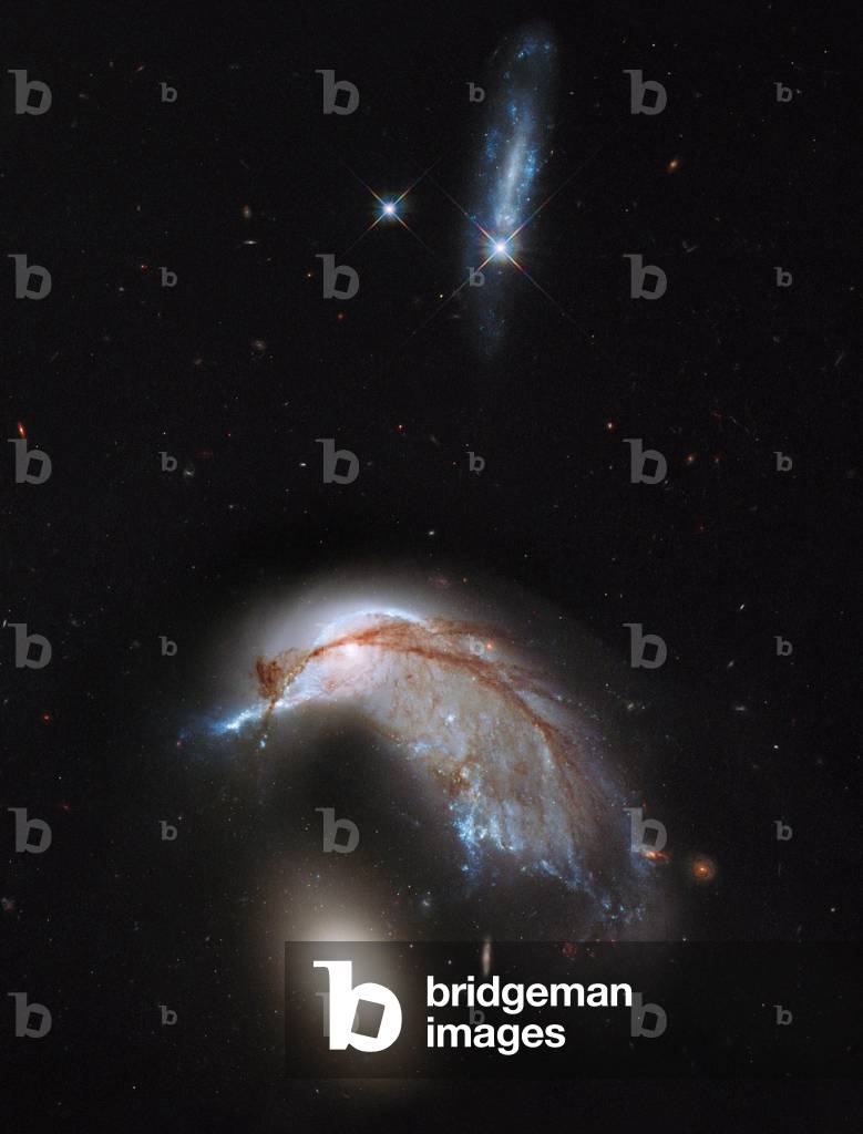
Interacting galaxies NGC 2936 and NGC 2937 - Interacting Galaxies NGC 2936 and NGC 2937 in Hydra - These two interacting galaxies also called Arp 142 are located approximately 326 million years ago - light from Earth in the constellation Hydra. NGC 2936 is a spiral galaxy, NGC 2937 is an elliptical galaxy. Above the torque, a blue galaxy UGC 5130, located closer to us is 230 million light years. Image obtained by the Hubble Space Telescope (HST). This interacting galaxy duo is collectively called Arp 142. The pair contains the disturbed, star - forming spiral galaxy NGC 2936, along with its elliptical companion, NGC 2937 at lower left. Once part of a flat, spiral disk, the orbits of the galaxy's stars have become scrambled due to gravitational tidal interactions with the other galaxy. This warps the galaxy's orderly spiral, and interstellar gas is strewn out into giant tails like stretched taffy. Gas and dust drawn from the heart of NGC 2936 becomes compressed during the encounter, which in turn triggers star formation. These bluish knots are visible along the distorted arms that are closest to the companion elliptical. The reddish dust, once within the galaxy, has been thrown out of the galaxy's plane and into dark veins that are silhouetted against the bright starlight from what is left of the nucleus and disk. The companion elliptical, NGC 2937, is a puffball of stars with little gas or dust present. The stars contained within the galaxy are mostly old, as evidenced by their reddish color. There are no blue stars that would be evidence of recent star formation. While the orbits of this elliptical's stars may be altered by the encounter, it's not apparent that the gravitational pull by its neighboring galaxy is having much of an effect. Above the pair, an unrelated, lone, bluish galaxy, inconsistently cataloged as UGC 5130, appears to be an elongated irregular or an edge - on spiral. Located 230 million light - ye
Space view over the Pyramid of Giza (photo)