[]
Your ongoing selection
Asset(s) Assets
Your quote 0

Your selection

Clear selection
Item added to cart
View cart and checkout
{"event":"pageview","page_type1":"catalog","page_type2":"image_page","language":"en","user_logged":"false","user_type":"ecommerce","nl_subscriber":"false"}
{"event":"ecommerce_event","event_name":"view_item","event_category":"browse_catalog","ecommerce":{"items":[{"item_id":"BL3284167","item_brand":"other","item_category":"illustration","item_category2":"out_of_copyright","item_category3":"standard","item_category5":"not_balown","item_list_name":"search_results","item_name":"a_map_of_the_river_merrimack_from_the_atlantick_ocean_to_pantuckett_falls_describing_bounds_between_","item_variant":"undefined"}]}}
Metadata Block (Hidden)

Contact us for further help

High res file dimension

Search for more high res images or videos

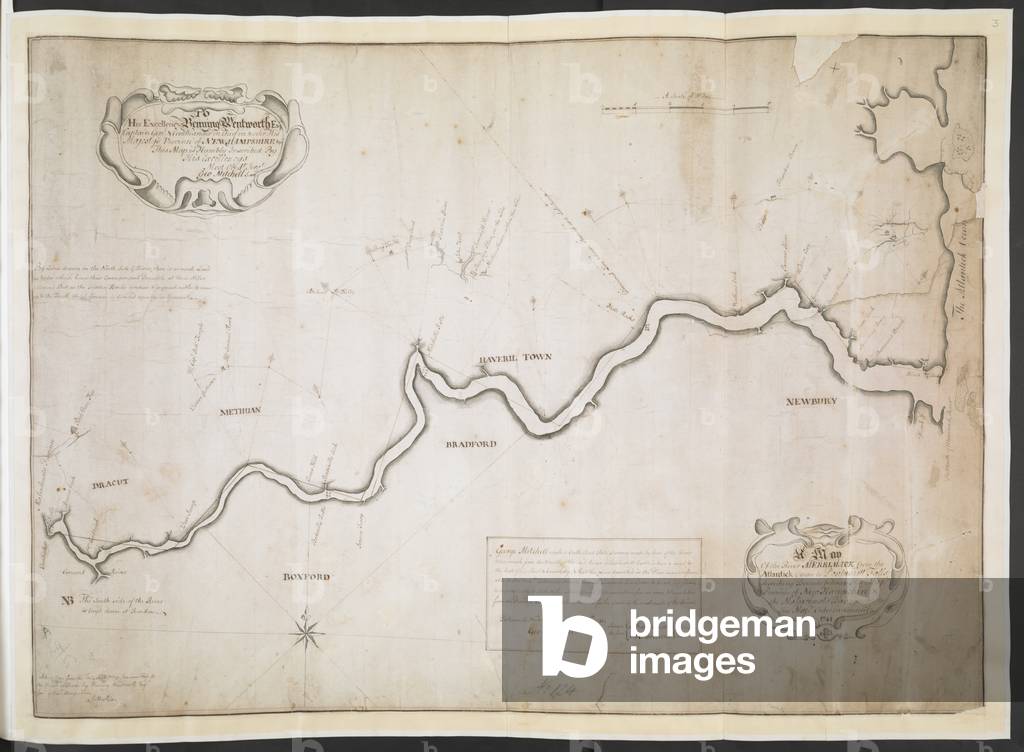
'A map of the River Merrimack from the Atlantick Ocean to Pantuckett Falls describing bounds...

Title

start

end

Add to cart

Contact us for other Usage Options

Pay for usage you need
Highest quality images
Buying Options
Editorial (Books, magazines and newspaper) - extended
Print and/or digital. Single use, any size, inside only. Single language only. Single territory rights for trade books; worldwide rights for academic books. Print run up to 5000. 7 years. (excludes advertising)
€154.00
Editorial (Books, magazines and newspaper) - standard
Print and/or digital. Single use, any size, inside only. Single language only. Single territory rights for trade books; worldwide rights for academic books. Print run up to 1500. 7 years. (excludes advertising)
€88.00
Largest available format 8581 × 6303 px 25 MB
Dimension [pixels] Dimension in 300dpi [mm] File size [MB] Online Purchase
Large 8581 × 6303 px 727 × 534 mm 25.0 MB
Medium 1024 × 752 px 87 × 64 mm 795 KB

Taxes may apply to prices shown

A £150 Service Fee may apply to Member-level clients (under £1,000/year spend) if an order is placed through our team, rather than directly online.

Looking for a different type of licence?

Image number

BL3284167

Image title

'A map of the River Merrimack from the Atlantick Ocean to Pantuckett Falls describing bounds between New Hampshire and Massachusetts Bay, agreeable to His Majesty's Order in Council 1741', surveyed by George Mitchell; aft. 1741. Copy , by G. Matthias.

Auto-translated text View Original Source

Image description

R.U.S.I. MAPS. Vol. LXXVI (1-13). 57711 (1-4). Places in states North-East of New York. 18th century Source/Shelfmark: Add. 57711.3 R.U.S.I. no. A 29.53. 1: 63360. Scale bar of 5 miles (= 5 inches). 510 x 720mm.

Read More

Photo credit

From the British Library archive / Bridgeman Images

Do you need support?

A £150 Service Fee may apply to Member-level clients (under £1,000/year spend) if an order is placed through our team, rather than directly online.

Copyright status
No Additional Copyright
Permissions
Permission required for non-editorial use (inc book and magazine covers). Please contact us
Largest available format 8581 × 6303 px 25 MB
Dimension [pixels] Dimension in 300dpi [mm] File size [MB] Online Purchase
Large 8581 × 6303 px 727 × 534 mm 25.0 MB
Medium 1024 × 752 px 87 × 64 mm 795 KB

Similar Images